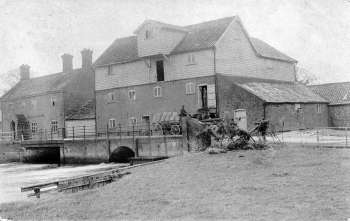
| Elsing Mill
River Wensum |
 |
c.1911 |
|
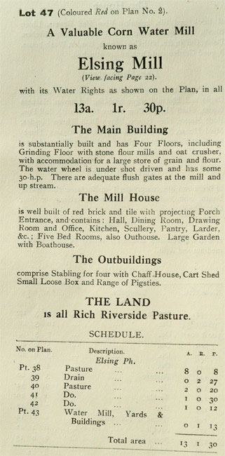
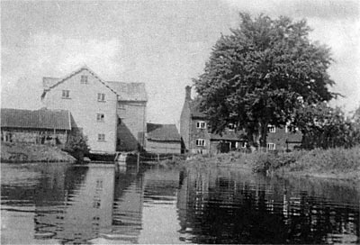
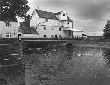
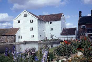
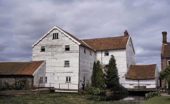
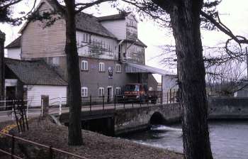
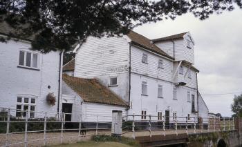
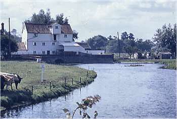
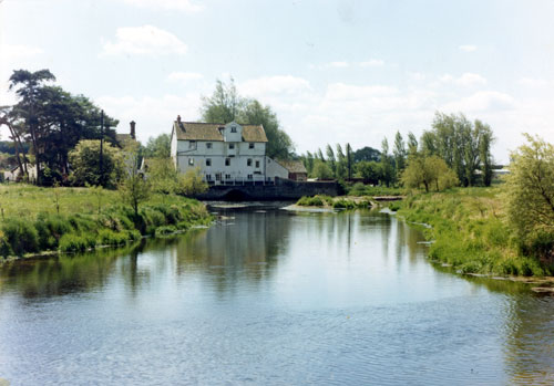
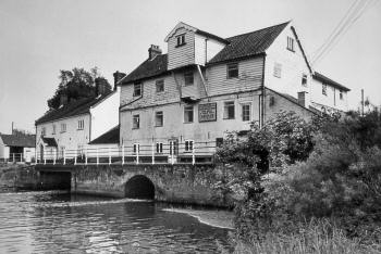
Elsing watermill was a paper mill between 1809 - 1818 and possibly longer. It was probably rebuilt in 1854 and then milled corn and crushed seed from that time using a 15 foot diameter wheel. It later turned to animal feed before ceasing work in 1970. The ground floor of the final structure was of rendered brick, with first floor of weatherboard and a Norfolk pantiled roof. The lucum was let into the attic section. |
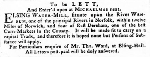 |
Norfolk Chronicle - 18th May 1776 |
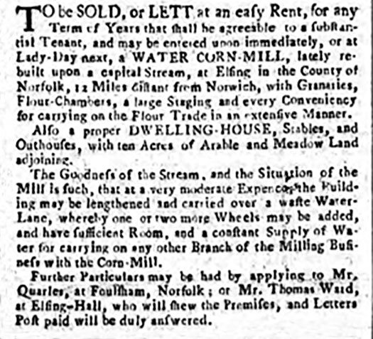 |
Norfolk Chronicle - 8th February 1777 |
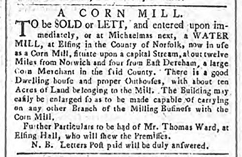 |
Norfolk Chronicle - 25th July 1778 |
In 1809 it was reported that three newly erected paper mills at Elsing were set to work on an entirely new principle. |
Commission of Bankruptcy against |
 |
26th January 1822 |
| Bankruptcy William Tuck of Elsing, Miller, Dealer and Chapman to surrender 3 March. Norfolk Chronicle - 18th February 1826 |
To be Sold by Auction by Wm. Butcher at the Kings Arms Inn, East Dereham on Monday November 28, 1831 at 1 o'c in Three Lots |
||
| Annual payments | Land tax Dunhams Cole |
£1 ....13.4 ---------- £1.13.4 |
Apply to Bignold, Pulley & Mawe, or Messrs. Sewell, Blake, Keith & Blake, Solrs. or to Mr. William Butcher, Auctioneer & Surveyor, all of Norwich. Norfolk Chronicle - 12th, 19th & 26th November 1831 |
||
Arthur Cole (1835-1902) was journeyman miller who travelled between many mills including Elsing. |
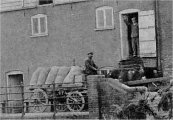 |
Detail of the loaded waggon from top photograph c.1911 |
Elsing mill came into the Sayer family as part of the Bylaugh Estate. While Robert Sayer was in charge the mill was making £500 per year. This healthy profit margin persuaded Robert's father James to take on and rebuild Lenwade mill in 1890. |
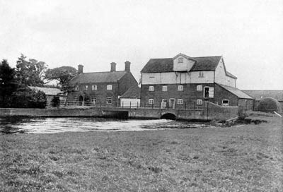 |
Sale Catalogue photo 1917 |
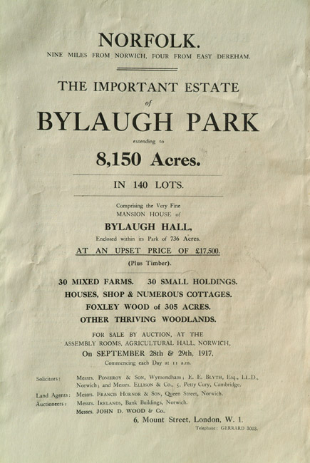
On 28th and 29th September 1917, the Bylaugh Estate was sold by auction at the Assembly Rooms, Agricultural Hall, Norwich by John D. Woods & Co of London and Irelands of Norwich. |
 |
 |
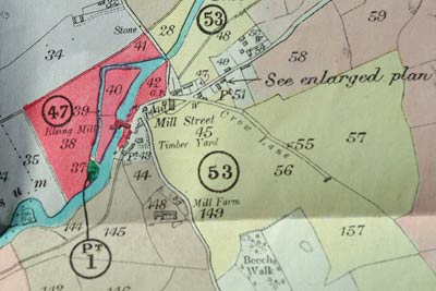 |
Sale Catalogue map 1917 |
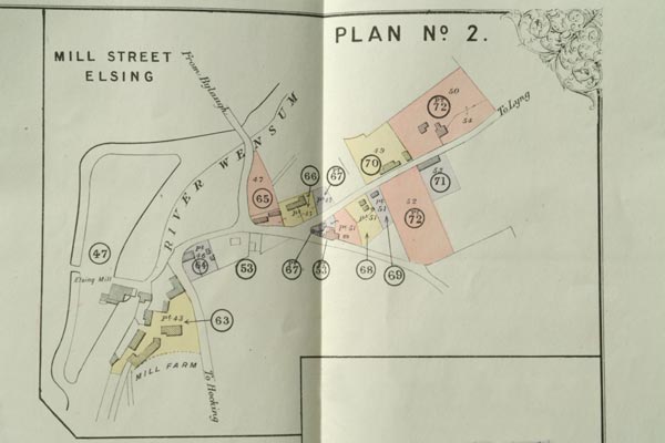 |
Sale Catalogue map 1917 |
 |
 |
|
Mill dam 1948
|
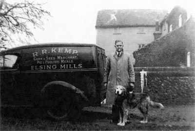
Ronald (Roly) Reginald Kemp outside mill 1948
|
Ronald (Roly) Reginald Kemp was born in the second quarter of 1908. He married Eva Dixon in the second quarter of 1939 and died in September 1969 aged 61. |
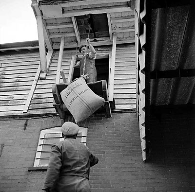 |
|
Victor Blowers & Ronald Kemp (?) 1967 |
The cocoa beans shown in the above photo were used to supplement cattle feed. |
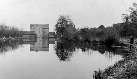 |
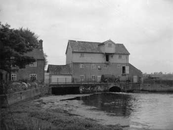 |
Mill dam 1951 |
1953 |
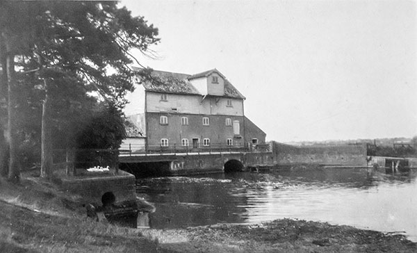 |
 |
c.1950 |
Mill dam 1951 |
 |
1970 |
Samuel Luck, brother of William Luck, from Luck's_Mill is shown as being journeyman miller in the 1841 census and again in 1851. Samuel was born on 14th January 1790 at Weybread. He married Elizabeth Scales on 5th January 1813, at Syleham, Suffolk. Elizabeth was born c.1783 Brockdish, Norfolk and died 1st March 1857 in Lyng, where Samuel also later died on 26th November 1859. |
Frederick William Kemp was born in 1841 and was master miller at Elsing watermill when he married in 1868. He ran Witton_(Blofield)_postmill from 1879 - 1879, then Croxton_postmill and towermill from 1883 - 1890 and was at Strumpshaw smockmill in 1896. |
 |
 |
|
Mill
dam September 1968
|
Mill dam c.1985 |
Ernest Hilton was tenant for 9 years from around 1915 - 1924 before returning to Swanton_Morley_postmill, where he had been brought up.. |
 |
 |
|
March
1967
|
c.1980 |
 |
|
c.1970
|
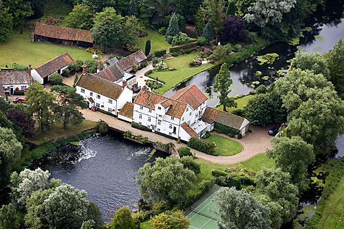
In 1972 the mill remained empty, complete with its iron wheel. |
 |
|
1974 |
 |
|
For
sale in 1976
|
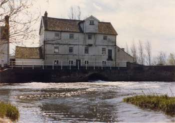 |
 |
|
1st
May 1977
|
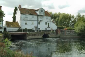
4th October 2003 |
 |
 |
|
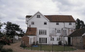
Side
view of the mill c.1985
|
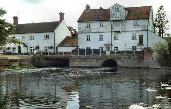
Mill
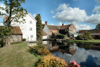
& house 4th October 2003 |
 |
|
Mill dam 4th October 2003 |
|
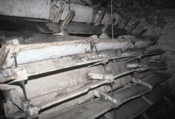
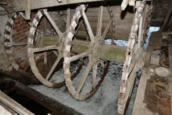
The wheel was still in situ in 2003 although the water authority had ensured that the majority of the paddles had been removed in order not to impede water flow. |
 |
 |
|
The
remaining wheel paddles 10th June 1988
|
The
wheel 4th October 2003 |
|
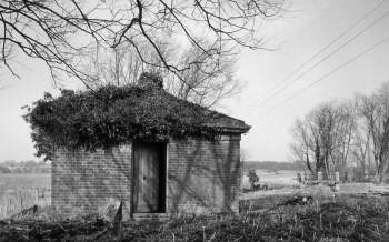
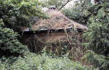
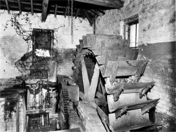
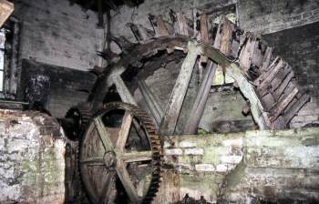
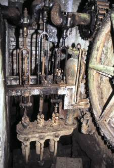
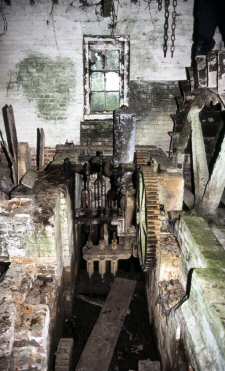
A second waterwheel was also in the grounds to pump water for Bylaugh Hall Estate and was used until 1967 |
 |
 |
|
The
Bylaugh pumphouse c.1967
|
The
Bylaugh pumphouse 10th June 1988 |
|
Although begining to look derelict in 1988 the pumphouse has since been reroofed. |
 |
 |
|
The
Bylaugh pump wheel in 1967
|
The
Bylaugh pump wheel 10th June 1988 |
 |
 |
|
The
pump 10th June 1988
|
The
pump and wheel 10th June 1988 |
 |
5th June 2008 |
Mill ownership and water rights |
|
5.28 The Environment Agency does not own all of the mills or water rights at control structures along the River Wensum SSSI (Table 6). Where private mill rights exist, the Environment Agency has limited powers to control their operational regime and retention levels. However, during initial contact with stakeholders, some mill owners were supportive of the concept of river restoration and were prepared to consider options for altering the future water management regime on impounded river reaches. 5.29 None of the mills are now used for their original purpose and only at Lenwade, Bintry and Elsing have the undershot water wheels been retained. Whilst owners can vary the retained water levels within the old milling limits, the general practice is to hold the water at a relatively high level. This is largely for aesthetic reasons (in order to maintain an expanse of water upstream of the mills) but also due to increasing levels of siltation of the mill pools. 5.30 The fragmentary nature of mill ownership is highlighted during periods of high flow. Each mill owner operates their controls to evacuate floodwaters, often without reference to owners either upstream or downstream. This emphasises the need for improved communication between mill owners/operators and riparian owners/residents. Given the significance of mills to restoration plans on the River Wensum, a potential constraint relates to the willingness of mill owners/operators to accept/implement changes in water levels, structures and channel works. 5.31 Conversely, mill owners may regard the development of the River Wensum Restoration Strategy as an opportunity for funding to modify structures that might be regarded as a liability in terms of maintenance, operation and health and safety. River Wensum Restoration Strategy - Natural England |
| N.B. Bintry Mill's wheel was removed in 1947 and Lenwade's c.1948. Elsing Mill's wheel had no paddleboards remaining by 2003 and was thus unable to impede the flow of water - JJN |
Mills |
|
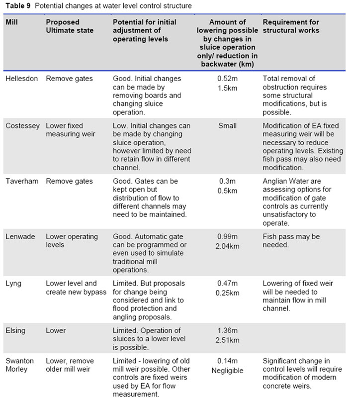
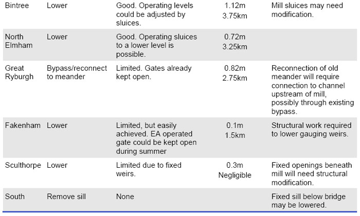
6.16 The mill structures have a profound influence on the river system in the Wensum catchment. If high retained water levels continue upstream of the mills, they would form a significant constraint on the effectiveness of river restoration. Physical modifications at mill sites should aim to restore a more natural longitudinal profile to the river and to remove or reduce physical barriers to the movement of fish and wildlife. Whilst historically a number of mills have been in existence for centuries these have always very actively stored and released water and the cessation of working of the mills in combination with dredging has had a significant impact. 6.17 The recommended actions at mill structures are shown in Table 9. At a number of sites there is no mill building and removal of water level control structures would be the desired course of action. However, often there are multiple channels at a mill site and it is likely that some hydraulic controls would be needed to maintain a split of flows to all channels. These would probably take the form of a fixed crest and a natural chute that would allow the passage of fish and woody debris. At locations where the water level control structures are part of the historic mill building, there is often a variety of passageways and the best way to lower levels will need to be identified using more detailed survey. Initial action can be taken at low cost by merely adjusting operating levels using the available gates and stop boards. The reduction in head that could be achieved at a typical dry weather flow is also summarised in Table 9. The estimated maximum reduction in backwater length through changing the operational level of the sluices (that is, without the need for major engineering works) is 18km. This would reduce the length of the River Wensum SSSI affected by backwater from mills from 67% to 40%. To achieve this it would be necessary to ensure that no channels downstream of gates or fixed weirs are affected, but this could be a cost effective start to the Wensum restoration. 6.18 It is likely that at some locations, where the channel course has been altered and the mill channel is significantly higher than the natural channel, the main flow could be diverted upstream of the current mill location. Maintaining some flow to the original mill weir is likely to be preferable for aesthetic and heritage reasons, so by-passing is likely to be required in conjunction with lowering of the mill weir. Sites where such a solution is envisaged are at Great Ryburgh and Lyng. 6.19 The control structures at Costessey, Swanton Morley and Fakenham are used for flow gauging by the Environment Agency. Lowering these weirs may mean that the existing gauging arrangements will need to be replaced by other methods, such as ultrasonic techniques. The weir on the main channel at Swanton Morley has a two stage drop and a significant reduction in water level could be achieved there without affecting flow gauging through the bridge. 6.20 A former mill known as Gogg‟s Mill near to Fakenham was removed as part of the drainage improvement works of the 1950s. The channel upstream of the mill has narrowed significantly through the accretion of silt berms, and provides a good case study of the extent to which natural recovery can help restore natural river form and function. 6.21 As part of the River Wensum Water Level Management Plan being prepared by Entec (2007) the views of some private owners on changes in operating level have been canvassed. In broad terms this is not opposed, but there is concern to maintain an attractive setting incorporating some mill pond in line with the historical context particularly at: 1) Elsing 2) Great Ryburgh 3) Bintree 4) North Elmham 5) Lenwade. 6.22 A reduction in the retained water level at mills may constrain the ability to direct water through all the existing channels at mill sites, should this still be required, there may be a need to carry out physical modifications to some of the subsidiary water level control structures. River Wensum Restoration Strategy - Natural England, 26th June 2009 |
 |
 |
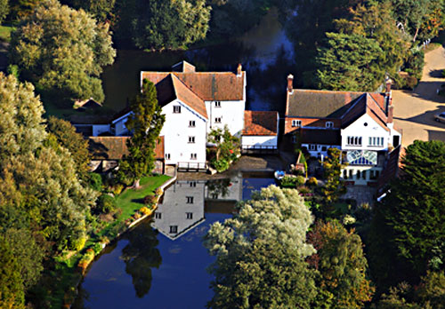
2nd October 2011 |
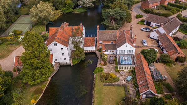
21st August 2024 |
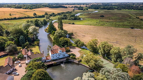
Villagers raise concerns about River Wensum at Elsing Parish Council meeting |
Concerns over the management of the River Wensum by the Environment Agency were voiced at a public discussion in a mid Norfolk village. |
 |
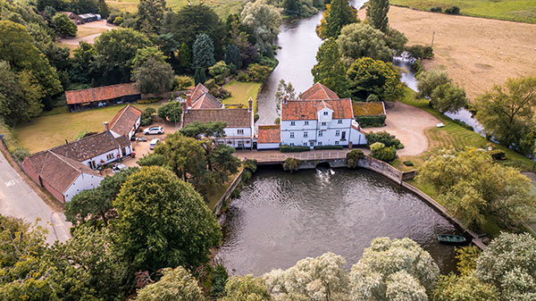 |
21st August 2024 |
|
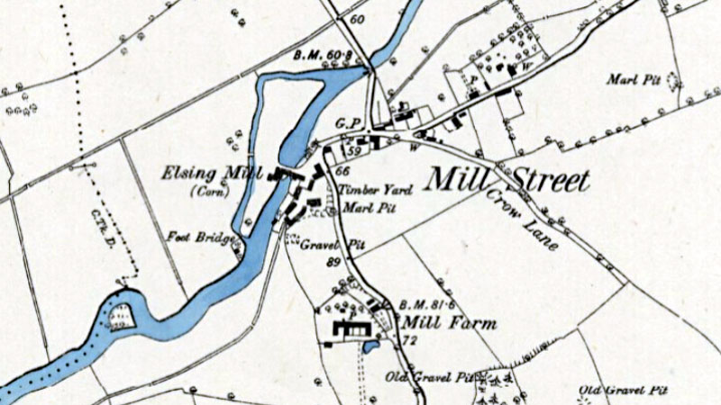 |
O. S. 6" Map 1881-82 (not to scale) Courtesy of NLS map images |
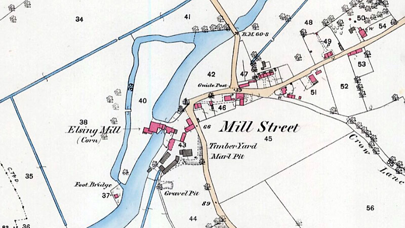 |
O. S. 25" Map 1882 (not to scale) Courtesy of NLS map images |
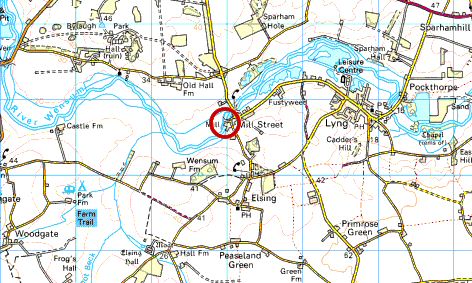 |
O.S. Map 2008 Image reproduced under licence from Ordnance Survey |
|
1776: Mill built
1948: Ronald (Roland) Reginald Kemp, miller, corn & seed merchant, pig & poultry meals |
If you have any memories, anecdotes or photos please let us know and we may be able to use them to update the site. By all means telephone 07836 675369 or
|
| Nat Grid Ref TG 04981768 | Copyright © Jonathan Neville 2003 |