|
Ringstead
southern postmill |
|
Ringstead southern postmill was the stood adjacent the northern postmill a few yards away. Both mills were under the same management and ownership. They stood at the end of a track some ¾ mile north of the village along with a cottage and outbuildings. |
|
Both Faden's and Greenwood's maps show two adjacent postmills at Ringstead, the northern mill and the southern mill, the latter was advertised for sale and removal before Henry L'Strange Styleman le Strange built a towermill on the same site c.1840. It was reputed that the southern postmill was moved about 2 miles east to Beacon Hill in Thornham, although up until 1863 the Rate Book in Thornham only records John Crane as owning one mill in Staithe Road even though both mills were known to be there in that year, thus the Ringstead southern postmill may have been assembled there during the course of that year, becoming Thornham_composite_mill. |
|
The mill used 2 pairs of 4 ft. French burr stones, a flour mill and a cylinder. A horse mill was also operated on the site and by 1830 a bake office was also being run that was capable of producing 30 stones of bread. |
THURLOW, Giles of Holme next the Sea, Miller |
Notice to Creditors |
To be Sold by Auction Sometime in the month of October |
Notice to Creditors of |
Royal Exchange Fire Insurance Policy No. 185269 |
12 Aug. 1801. Matthew Green & Samuel Herring of Ringstead, Co. of Norfolk, Millers. |
RINGSTEAD |
|
Grinding capacity in 1830: |
To Millers & Bakers |
To be Sold by Auction on 3 June, 1834, at the Duke's Head in King's Lynn, Norfolk. |
RINGSTEAD |
To be Peremptorily Sold by Auction at the Compasses Inn, in Ringstead, in the county of Norfolk, on 20 May, 1836. |
To be SOLD or LET |
To be Sold by Private Contract |
 |
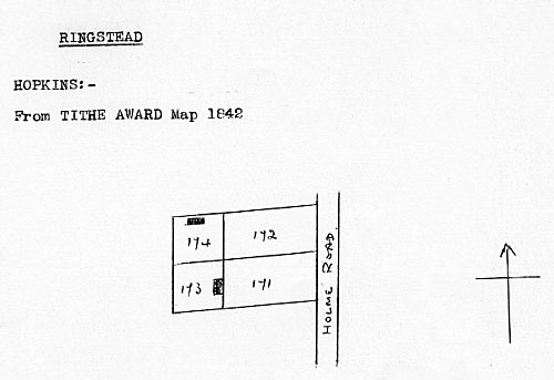
Redrawn tithe map 1842 |
Tithe Award 1842 |
||||
No. 175 |
Mill & yard |
Arable |
0a. 3r. 1p. |
15s. |
|
This mill or the northern mill was removed and taken to Beacon Hill Road in the adjacent village of Thornham in the latter half of the 1800s before being re-erected as Thornham composite mill. |
One of the mills was removed to Thornham, by the road leading to the granaries, where it now (1930) is. |
|
Robert Mitchell's Navigation Chart, Spurn Head to Wells 1749: Windmill |
If you have any memories, anecdotes or photos please let us know and we may be able to use them to update the site. By all means telephone 07836 675369 or
|
| Nat Grid Ref TF70564161 |
Copyright © Jonathan Neville 2008 |