Snetterton
Mill Farm
postmill

Contact

Drainage Mills (Windpumps)
Steam Mills
Watermills

Buxton MSS is a collection of Norfolk documents in the Cambridge University library. Two documents are: a Field Book of Hargham & Snettereton, dated 1681 and A Roll containing rental of one of the Manors of Snetterton Parishes (Pary's or Grimes) dated 1465.
Windmills for grinding corn exiszted at various times in both parishes. The 1681 map shows two in Snetterton, one of which was disused.
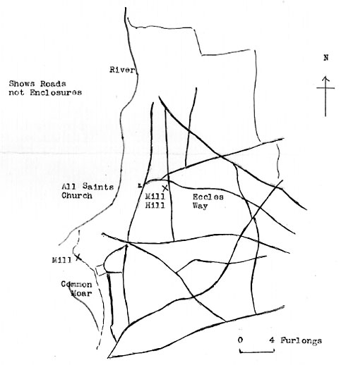
Map No. 3, Snetterton in 1681, shows the two mills.
TL997909
is 3-400 yards east of the church, is given as at MILL_HILL in 1465 and in 1681 when it would probably be the one then disused. TL985902, between KNOLL MOAR and COMMON MOAR (1681) would be the site of the later smock mill near MILL FARM.
Norfolk Archaeology Vol. XXXV, Part III - 1972


1861 map
Norfolk Arcaeology Vol XXXV 1972 - 1861 map

Ogilvy's Britania map London to Norwich 1675: Windmill

Buxton MSS map 1681: Windmill

c.1820: Smockmill built on postmill site


If you have any memories, anecdotes or photos please let us know and we may be able to use them to update the site. By all means telephone 07836 675369 or

Nat Grid Ref TL98559023
Top of Page

Copyright © Jonathan Neville 2011