|
Thetford
Norwich Road postmill |
|
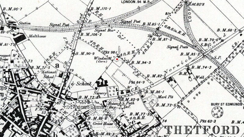
Thetford Norwich Road postmill stood on the north side of the town, to the south of what is now Vicarage Road between the Croxton Road and the Norwich Road and just southeast of the Croxton_Road_postmill. |
 |
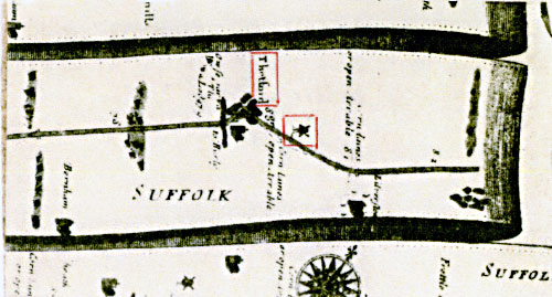
Ogilby's Britannia London to Norwich map - 1675 |
Mr. Green's mill raised at Thetford July 1817. Diary of Thomas King of Thelnetham - 1804 - 1838 Henry Green's mill was probably originally built as an open trestle mill. At some point the mill was set onto a roundhouse and this was increased in height in 1817, which in turn raised the height of the mill buck. This was deemed necessary to ensure the mill retained full access to wind as nearby house building began to encroach. |
 |
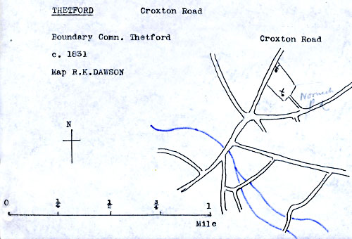
Boundary Commission map c.1831 - original S. A. Rumball, redrawn by Harry Apling Norwich Road postmill to the southeast and Croxton Rd mill to the north |
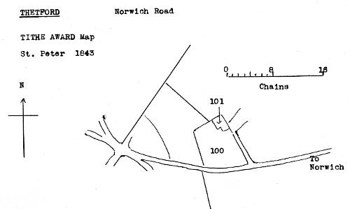
Tithe Award 1844 |
|||||
No. 100 |
Mill Close |
Arable |
4a. 1r. 14p. |
£1. 9. 8 |
|
 |
Tithe Award map 1843 - redrawn by Harry Apling |
 |
|
O. S. Map 1882 Courtesy of NLS map images |
|
Ogilby's Britannia map London to Norwich 1675: Windmill |
| If you have any memories, anecdotes or photos please let us know and we may be able to use them to update the site. By all means telephone 07836 675369 or |
| Nat Grid Ref TL87278353 |
Copyright © Jonathan Neville 2011 |